19.85.007 Infrastructure.
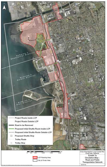
A. Circulation Standards – Primary Vehicular Circulation. The primary vehicular routes are identified as “Circulation and Other” in Exhibit 5, Zoning Map, and in Exhibits 7a, 7b, and 7c, Circulation Maps. These consist of Interstate 5, State Route 54, Bay Boulevard, Marina Parkway, E Street, F Street, H Street, J Street, and three new proposed streets: Street A, Street B, and Street C. The filling of wetlands for primary and internal circulation roads under the control of the City is not permitted.
1. Internal Vehicular Circulation. Internal roadways shall be developed to the design and construction standards published by the Department of Engineering, City of Chula Vista.
2. Pedestrian Route. The major pedestrian routes shown in Exhibit 7b, Circulation Map, shall be a minimum of six feet in width. The filling of wetlands for pedestrian paths is not permitted.
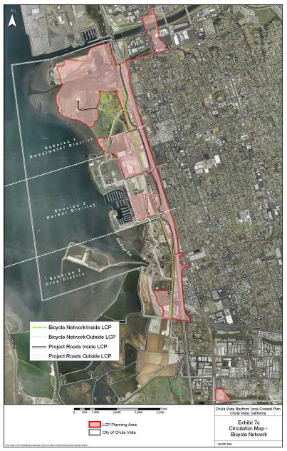
3. Bike Routes.
a. Bike Lane. A bike lane is a lane on the paved area of a street for preferential use by bicycles. These lanes are used for regional bicycle routes. On-street parking, except for emergency stopping, will not be permitted where bike lanes are designed. Bike lanes shall be a minimum of five feet in width. The filling of wetlands for bike paths is not permitted.
b. Bike Path. A bike path is used for off-street travel by bicycles. These paths shall be a minimum of eight feet in width. All proposed bicycle routes are shown in Exhibit 7c, Circulation Map.
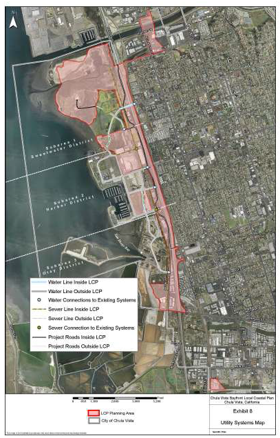
B. Utility Systems. Refer also to Exhibit 8.
1. General Policies.
a. Provide adequate sizing of utility systems to ensure sufficient capacity for maximum build-out potential of plan.
b. Protect existing sensitive natural resources from adverse impacts during construction.

(Ord. 3352 § 2, 2015; Ord. 3238 § 2 (Exh. B, C), 2012; Ord. 2532, 1992).